Let the Apple Car rumors roll on. Apple has filed for a patent (number 20200166348) for “navigation system acquisition and use of cellular coverage map data.” The idea is to improve an iPhone’s ability to communicate with a vehicle’s navigation system to find the best route to a destination.
In the patent filing, Apple notes that the fairly fast speeds and which automobiles and trains travel, combined with the often limited communication range of wireless network signal transmitters/receivers, sometimes further complicated by highly varied types of geographical terrain in some regions, can unexpectedly lead to a much-weakened wireless network signal right in the middle of the communication session that a traveling person is conducting using his mobile device.

When such communication sessions are lengthy in duration, and when the route of travel is long, the opportunities for dropped calls and/or poor packetized data transmissions can become irritatingly frequent. A traveling person needing to conduct an important but lengthy communication session using his mobile device often will have a difficult time planning an opportune time to engage in that session.
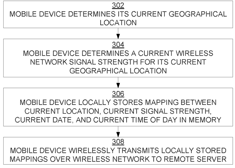
In part, Apple’s idea is for the iPhone to request wireless network signal strength map data over a wireless network from a remote server at which such map data is stored. There are various ways in which such map data can be generated for storage at the remote server. Per Apple’s idea, a mobile device wouldn’t have to contact the remote server at all, but could collect and use wireless network signal strength map data that it has collected and stored based on its own historical experiences alone.
Or perhaps iPhones could cooperatively collect such data based on their own historical experiences and wirelessly upload that data to the remote server. The data from all of the mobile devices could be aggregated in order to obtain potentially more accurate, more complete, and more current map data that then can be distributed wirelessly back to requesting mobile devices.
Here’s the summary of the patent filing; “A mobile device can obtain wireless network signal strength map data that indicates, for various nearby geographical regions, the wireless network signal strength in each such region. A mobile device can transmit that data to a vehicular navigation system responsible for automatically selecting a high-quality route of vehicular travel between a specified source and destination. The system can take the wireless network signal map data into account when selecting that route.
“When selecting from among multiple different routes of vehicular travel between a specified source and destination, the system may employ an algorithm that considers wireless network signal strengths along those routes, in addition to the other factors. Consequently, the system can select a longer route having better signal strength over a shorter route having worse signal strength. The system can present the selected route within a set of suggested routes, potentially along with reasons for each route’s suggestion.”
